Comparaison

Sélection

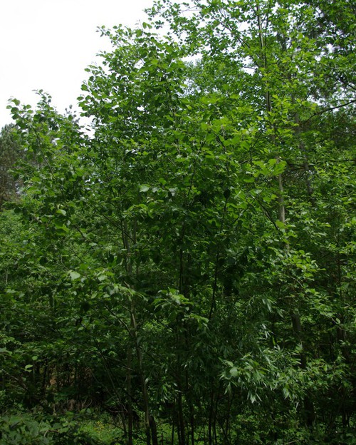
Alnus incana

Aulne blanchâtre

Photos

Photos épinglées

Alnus incana
Individu
6
Critères
Critère Alnus incana
Période floraison ou sporulation
  • J
  • F
  • M
  • A
  • M
  • J
  • J
  • A
  • S
  • O
  • N
  • D
Rareté Non renseignée
Hauteur mini-maxi 2 - 20 m
Nombre de pétales ou de tépales
4
Aucun pétale
Habitat
Forêt, haie, lisière, chemin forestier (laie)
Zone humide, tourbière, rives
Nombre d'étamines
4
Inflorescence détail
Inflorescence femelle en cône, persistant
Sommet des feuilles
Feuillet à sommet en pointe ou acuminé
Détail du fruit
Cône sessile ou très faiblement pédonculé
Pilosité des feuilles
Feuille pubescente non glanduleuse
Type de plante
Plante ligneuse
  • Arbre
Type biologique
Plante terrestre
  • Plante ligneuse
Disposition des feuilles
Tige aérienne avec feuilles
  • Alternes
Forme des feuilles indivises
Rapport longueur / largeur 1-2
  • Ovale, oblongue ou obovale
Bord des limbes
Echancrures < 20% du limbe
  • Denté
Dimension de la fleur en mm
Plante à fleurs nues
  • Pièces florales absentes ou transformées en soies
Type d'inflorescence
Fleurs regroupées
  • Epi ou épi composé
  • Cyme ou cyme composée
Forme de la tige ou de la hampe florale
Tige cylindrique
  • Lisse ou finement striée
Aspect du tronc
Gris
  • Lisse
Couleur dominante des pièces pétaloides
Jaune
Verdâtre
Brunâtre
Pas de calice ni de corolle
Position de l'ovaire
Supère
Infère
Port de la plante
Arbre
Caractère particulier
Présence de stipules ou d'ochréas
Structure de la feuille
Feuille non découpée
  • Simple, non découpée
Type de fleur
Autre
  • Autre (Voir aide)
Type de fruit
Sec indéhiscent
  • Akène simple
Phénologie
[{"cd_nom": 81570, "mois_values": [{"mois": "Janvier", "value": 3}, {"mois": "F\u00e9vrier", "value": 0}, {"mois": "Mars", "value": 0}, {"mois": "Avril", "value": 1}, {"mois": "Mai", "value": 3}, {"mois": "Juin", "value": 4}, {"mois": "Juillet", "value": 4}, {"mois": "Ao\u00fbt", "value": 1}, {"mois": "Septembre", "value": 4}, {"mois": "Octobre", "value": 1}, {"mois": "Novembre", "value": 0}, {"mois": "D\u00e9cembre", "value": 0}], "scientific_name": "Alnus incana"}]
Carte des observations
[{"cd_nom": 81570, "first_year": 2016.0, "geojson_maille": {"coordinates": [[[[1.76964607821781, 49.0135969007519], [1.77007191328069, 48.9956151249547], [1.74274474694758, 48.9953319021735], [1.74230945363044, 49.0133135847473], [1.76964607821781, 49.0135969007519]]]], "type": "MultiPolygon"}, "last_year": 2020.0, "observation_number": 2, "scientific_name": "Alnus incana"}, {"cd_nom": 81570, "first_year": 1980.0, "geojson_maille": {"coordinates": [[[[1.96744562216761, 48.6916776854257], [1.96780080126304, 48.6736900738603], [1.94064088192933, 48.6734518306436], [1.94027635933805, 48.6914393638589], [1.96744562216761, 48.6916776854257]]]], "type": "MultiPolygon"}, "last_year": 1980.0, "observation_number": 1, "scientific_name": "Alnus incana"}, {"cd_nom": 81570, "first_year": 2008.0, "geojson_maille": {"coordinates": [[[[1.99253510924604, 48.799830095437], [1.99288237673228, 48.781844088067], [1.96566605407431, 48.7816115736604], [1.96530940415972, 48.7995975045411], [1.99253510924604, 48.799830095437]]]], "type": "MultiPolygon"}, "last_year": 2008.0, "observation_number": 1, "scientific_name": "Alnus incana"}, {"cd_nom": 81570, "first_year": 1996.0, "geojson_maille": {"coordinates": [[[[2.02077401002885, 48.746097387296], [2.02111119703121, 48.7281104570455], [1.9939227443387, 48.7278843652552], [1.99357619403152, 48.74587122114], [2.02077401002885, 48.746097387296]]]], "type": "MultiPolygon"}, "last_year": 1996.0, "observation_number": 1, "scientific_name": "Alnus incana"}, {"cd_nom": 81570, "first_year": 2022.0, "geojson_maille": {"coordinates": [[[[2.02447033975054, 48.5482261045016], [2.0248049865307, 48.530236204561], [1.99771910636431, 48.5300109289411], [1.99737516679602, 48.5480007548243], [2.02447033975054, 48.5482261045016]]]], "type": "MultiPolygon"}, "last_year": 2022.0, "observation_number": 1, "scientific_name": "Alnus incana"}, {"cd_nom": 81570, "first_year": 2017.0, "geojson_maille": {"coordinates": [[[[2.12655882262197, 48.9267964194068], [2.12686062929499, 48.9088121034224], [2.09957735340705, 48.9086101223541], [2.09926611769185, 48.9265943718684], [2.12655882262197, 48.9267964194068]]]], "type": "MultiPolygon"}, "last_year": 2017.0, "observation_number": 1, "scientific_name": "Alnus incana"}, {"cd_nom": 81570, "first_year": 2024.0, "geojson_maille": {"coordinates": [[[[2.18648763356125, 48.5854283850582], [2.18676690201413, 48.5674386065223], [2.15966114580153, 48.5672502344479], [2.15937257047546, 48.5852399510504], [2.18648763356125, 48.5854283850582]]]], "type": "MultiPolygon"}, "last_year": 2024.0, "observation_number": 1, "scientific_name": "Alnus incana"}, {"cd_nom": 81570, "first_year": 2023.0, "geojson_maille": {"coordinates": [[[[2.21197921863199, 48.6935440577552], [2.21225029571148, 48.6755558325911], [2.18508840938372, 48.675373276275], [2.1848079867773, 48.6933614414], [2.21197921863199, 48.6935440577552]]]], "type": "MultiPolygon"}, "last_year": 2023.0, "observation_number": 1, "scientific_name": "Alnus incana"}, {"cd_nom": 81570, "first_year": 2024.0, "geojson_maille": {"coordinates": [[[[2.21252118636168, 48.6575673339664], [2.21279189077483, 48.6395785637144], [2.18564867622985, 48.6393961274083], [2.18536863913495, 48.6573848376667], [2.21252118636168, 48.6575673339664]]]], "type": "MultiPolygon"}, "last_year": 2024.0, "observation_number": 2, "scientific_name": "Alnus incana"}, {"cd_nom": 81570, "first_year": 2023.0, "geojson_maille": {"coordinates": [[[[2.23915063710844, 48.6937204843044], [2.23941236846849, 48.675732201136], [2.21225029571148, 48.6755558325911], [2.21197921863199, 48.6935440577552], [2.23915063710844, 48.6937204843044]]]], "type": "MultiPolygon"}, "last_year": 2023.0, "observation_number": 1, "scientific_name": "Alnus incana"}, {"cd_nom": 81570, "first_year": 2018.0, "geojson_maille": {"coordinates": [[[[2.34806239526189, 48.6763757964391], [2.34828658765574, 48.658387028244], [2.32113317344192, 48.6582354612068], [2.32089964105206, 48.6762241795562], [2.34806239526189, 48.6763757964391]]]], "type": "MultiPolygon"}, "last_year": 2018.0, "observation_number": 1, "scientific_name": "Alnus incana"}, {"cd_nom": 81570, "first_year": 2024.0, "geojson_maille": {"coordinates": [[[[2.37779381476565, 48.4606379166359], [2.37800690441543, 48.4426459633843], [2.3509649189959, 48.4425011546956], [2.35074256580492, 48.4604930603515], [2.37779381476565, 48.4606379166359]]]], "type": "MultiPolygon"}, "last_year": 2024.0, "observation_number": 1, "scientific_name": "Alnus incana"}, {"cd_nom": 81570, "first_year": 2022.0, "geojson_maille": {"coordinates": [[[[2.40094580808071, 48.8025747427265], [2.40115231317371, 48.7845878327288], [2.37393307974213, 48.7844483169663], [2.37371718920887, 48.8024351810654], [2.40094580808071, 48.8025747427265]]]], "type": "MultiPolygon"}, "last_year": 2022.0, "observation_number": 1, "scientific_name": "Alnus incana"}, {"cd_nom": 81570, "first_year": 2015.0, "geojson_maille": {"coordinates": [[[[2.67278741144359, 48.875575368563], [2.67290036648504, 48.8575892669403], [2.64564241558855, 48.8575116545856], [2.64552004799166, 48.8754977306691], [2.67278741144359, 48.875575368563]]]], "type": "MultiPolygon"}, "last_year": 2015.0, "observation_number": 1, "scientific_name": "Alnus incana"}, {"cd_nom": 81570, "first_year": 2024.0, "geojson_maille": {"coordinates": [[[[2.72974879769855, 48.4079822237676], [2.72984125990462, 48.3899890933886], [2.7028256293983, 48.3899244537787], [2.70272392122173, 48.4079175629144], [2.72974879769855, 48.4079822237676]]]], "type": "MultiPolygon"}, "last_year": 2024.0, "observation_number": 2, "scientific_name": "Alnus incana"}, {"cd_nom": 81570, "first_year": 2015.0, "geojson_maille": {"coordinates": [[[[2.80892732233141, 48.9298272221162], [2.80899335023049, 48.911841909016], [2.78170681631507, 48.9117952953502], [2.78163135599419, 48.9297805931092], [2.80892732233141, 48.9298272221162]]]], "type": "MultiPolygon"}, "last_year": 2015.0, "observation_number": 1, "scientific_name": "Alnus incana"}, {"cd_nom": 81570, "first_year": 2020.0, "geojson_maille": {"coordinates": [[[[2.80932280640134, 48.8219109248474], [2.80938856130049, 48.8039238571493], [2.78215848530199, 48.8038773354082], [2.78208333697991, 48.8218643878], [2.80932280640134, 48.8219109248474]]]], "type": "MultiPolygon"}, "last_year": 2020.0, "observation_number": 1, "scientific_name": "Alnus incana"}, {"cd_nom": 81570, "first_year": 2012.0, "geojson_maille": {"coordinates": [[[[2.86501260283042, 48.3542328074519], [2.86505873956442, 48.3362388750408], [2.83807055683665, 48.336205049403], [2.83801519282701, 48.354198970699], [2.86501260283042, 48.3542328074519]]]], "type": "MultiPolygon"}, "last_year": 2012.0, "observation_number": 1, "scientific_name": "Alnus incana"}, {"cd_nom": 81570, "first_year": 2024.0, "geojson_maille": {"coordinates": [[[[3.24330953566429, 48.4260336303837], [3.24322626251258, 48.4080407265102], [3.21620126574263, 48.4080930711222], [3.21627528646937, 48.4260859921993], [3.24330953566429, 48.4260336303837]]]], "type": "MultiPolygon"}, "last_year": 2024.0, "observation_number": 1, "scientific_name": "Alnus incana"}]