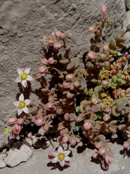
[{"cd_nom": 122150, "first_year": 2020.0, "geojson_maille": {"coordinates": [[[[1.83200377556871, 48.6724369880448], [1.83240539312515, 48.654449514724], [1.80525612710374, 48.6541804255591], [1.8048451738331, 48.6721678103925], [1.83200377556871, 48.6724369880448]]]], "type": "MultiPolygon"}, "last_year": 2020.0, "observation_number": 1, "scientific_name": "Sedum dasyphyllum"}, {"cd_nom": 122150, "first_year": 2013.0, "geojson_maille": {"coordinates": [[[[2.31761323583466, 48.9280366968149], [2.31784903353548, 48.9100519727948], [2.2905644349822, 48.9098934916833], [2.29031920686724, 48.9278781635473], [2.31761323583466, 48.9280366968149]]]], "type": "MultiPolygon"}, "last_year": 2013.0, "observation_number": 1, "scientific_name": "Sedum dasyphyllum"}, {"cd_nom": 122150, "first_year": 2013.0, "geojson_maille": {"coordinates": [[[[2.31784903353548, 48.9100519727948], [2.31808466833758, 48.8920669515208], [2.29080949368455, 48.8919085225455], [2.2905644349822, 48.9098934916833], [2.31784903353548, 48.9100519727948]]]], "type": "MultiPolygon"}, "last_year": 2013.0, "observation_number": 1, "scientific_name": "Sedum dasyphyllum"}, {"cd_nom": 122150, "first_year": 2013.0, "geojson_maille": {"coordinates": [[[[2.31808466833758, 48.8920669515208], [2.31832014040969, 48.8740816348326], [2.29105438314978, 48.8739232579737], [2.29080949368455, 48.8919085225455], [2.31808466833758, 48.8920669515208]]]], "type": "MultiPolygon"}, "last_year": 2013.0, "observation_number": 1, "scientific_name": "Sedum dasyphyllum"}, {"cd_nom": 122150, "first_year": 2013.0, "geojson_maille": {"coordinates": [[[[2.31832014040969, 48.8740816348326], [2.31855544992032, 48.8560960245692], [2.29129910355313, 48.855937699807], [2.29105438314978, 48.8739232579737], [2.31832014040969, 48.8740816348326]]]], "type": "MultiPolygon"}, "last_year": 2013.0, "observation_number": 1, "scientific_name": "Sedum dasyphyllum"}, {"cd_nom": 122150, "first_year": 2013.0, "geojson_maille": {"coordinates": [[[[2.31855544992032, 48.8560960245692], [2.31879059703776, 48.8381101225693], [2.2915436550696, 48.8379518498839], [2.29129910355313, 48.855937699807], [2.31855544992032, 48.8560960245692]]]], "type": "MultiPolygon"}, "last_year": 2013.0, "observation_number": 1, "scientific_name": "Sedum dasyphyllum"}, {"cd_nom": 122150, "first_year": 2013.0, "geojson_maille": {"coordinates": [[[[2.31879059703776, 48.8381101225693], [2.31902558193005, 48.820123930671], [2.29178803787397, 48.8199657100428], [2.2915436550696, 48.8379518498839], [2.31879059703776, 48.8381101225693]]]], "type": "MultiPolygon"}, "last_year": 2013.0, "observation_number": 1, "scientific_name": "Sedum dasyphyllum"}, {"cd_nom": 122150, "first_year": 2022.0, "geojson_maille": {"coordinates": [[[[2.32415454381029, 48.4243580787224], [2.32438584337658, 48.4063657253433], [2.29736267621285, 48.4062086966108], [2.29712212610135, 48.424200998383], [2.32415454381029, 48.4243580787224]]]], "type": "MultiPolygon"}, "last_year": 2022.0, "observation_number": 1, "scientific_name": "Sedum dasyphyllum"}, {"cd_nom": 122150, "first_year": 2014.0, "geojson_maille": {"coordinates": [[[[2.32438584337658, 48.4063657253433], [2.32461698468219, 48.3883731260317], [2.29760306173521, 48.3882161488868], [2.29736267621285, 48.4062086966108], [2.32438584337658, 48.4063657253433]]]], "type": "MultiPolygon"}, "last_year": 2016.0, "observation_number": 4, "scientific_name": "Sedum dasyphyllum"}, {"cd_nom": 122150, "first_year": 2013.0, "geojson_maille": {"coordinates": [[[[2.34490742786974, 48.9281890135248], [2.34513379498745, 48.9102042393937], [2.31784903353548, 48.9100519727948], [2.31761323583466, 48.9280366968149], [2.34490742786974, 48.9281890135248]]]], "type": "MultiPolygon"}, "last_year": 2013.0, "observation_number": 1, "scientific_name": "Sedum dasyphyllum"}, {"cd_nom": 122150, "first_year": 2013.0, "geojson_maille": {"coordinates": [[[[2.34513379498745, 48.9102042393937], [2.34536000572055, 48.8922191680277], [2.31808466833758, 48.8920669515208], [2.31784903353548, 48.9100519727948], [2.34513379498745, 48.9102042393937]]]], "type": "MultiPolygon"}, "last_year": 2013.0, "observation_number": 1, "scientific_name": "Sedum dasyphyllum"}, {"cd_nom": 122150, "first_year": 2013.0, "geojson_maille": {"coordinates": [[[[2.34536000572055, 48.8922191680277], [2.34558606023103, 48.8742338012664], [2.31832014040969, 48.8740816348326], [2.31808466833758, 48.8920669515208], [2.34536000572055, 48.8922191680277]]]], "type": "MultiPolygon"}, "last_year": 2013.0, "observation_number": 1, "scientific_name": "Sedum dasyphyllum"}, {"cd_nom": 122150, "first_year": 2013.0, "geojson_maille": {"coordinates": [[[[2.34558606023103, 48.8742338012664], [2.34581195868068, 48.8562481409491], [2.31855544992032, 48.8560960245692], [2.31832014040969, 48.8740816348326], [2.34558606023103, 48.8742338012664]]]], "type": "MultiPolygon"}, "last_year": 2013.0, "observation_number": 1, "scientific_name": "Sedum dasyphyllum"}, {"cd_nom": 122150, "first_year": 2013.0, "geojson_maille": {"coordinates": [[[[2.34581195868068, 48.8562481409491], [2.34603770123104, 48.8382621889142], [2.31879059703776, 48.8381101225693], [2.31855544992032, 48.8560960245692], [2.34581195868068, 48.8562481409491]]]], "type": "MultiPolygon"}, "last_year": 2013.0, "observation_number": 1, "scientific_name": "Sedum dasyphyllum"}, {"cd_nom": 122150, "first_year": 2013.0, "geojson_maille": {"coordinates": [[[[2.34603770123104, 48.8382621889142], [2.34626328804343, 48.820275947], [2.31902558193005, 48.820123930671], [2.31879059703776, 48.8381101225693], [2.34603770123104, 48.8382621889142]]]], "type": "MultiPolygon"}, "last_year": 2013.0, "observation_number": 1, "scientific_name": "Sedum dasyphyllum"}, {"cd_nom": 122150, "first_year": 2013.0, "geojson_maille": {"coordinates": [[[[2.37220177645162, 48.928335113625], [2.37241871282399, 48.9103502914278], [2.34513379498745, 48.9102042393937], [2.34490742786974, 48.9281890135248], [2.37220177645162, 48.928335113625]]]], "type": "MultiPolygon"}, "last_year": 2013.0, "observation_number": 1, "scientific_name": "Sedum dasyphyllum"}, {"cd_nom": 122150, "first_year": 2013.0, "geojson_maille": {"coordinates": [[[[2.37241871282399, 48.9103502914278], [2.37263549932609, 48.8923651720141], [2.34536000572055, 48.8922191680277], [2.34513379498745, 48.9102042393937], [2.37241871282399, 48.9103502914278]]]], "type": "MultiPolygon"}, "last_year": 2013.0, "observation_number": 1, "scientific_name": "Sedum dasyphyllum"}, {"cd_nom": 122150, "first_year": 2013.0, "geojson_maille": {"coordinates": [[[[2.37263549932609, 48.8923651720141], [2.37285213611318, 48.8743797572234], [2.34558606023103, 48.8742338012664], [2.34536000572055, 48.8922191680277], [2.37263549932609, 48.8923651720141]]]], "type": "MultiPolygon"}, "last_year": 2020.0, "observation_number": 2, "scientific_name": "Sedum dasyphyllum"}, {"cd_nom": 122150, "first_year": 2013.0, "geojson_maille": {"coordinates": [[[[2.37285213611318, 48.8743797572234], [2.37306862334029, 48.8563940488948], [2.34581195868068, 48.8562481409491], [2.34558606023103, 48.8742338012664], [2.37285213611318, 48.8743797572234]]]], "type": "MultiPolygon"}, "last_year": 2013.0, "observation_number": 1, "scientific_name": "Sedum dasyphyllum"}, {"cd_nom": 122150, "first_year": 2013.0, "geojson_maille": {"coordinates": [[[[2.37306862334029, 48.8563940488948], [2.37328496116223, 48.838408048867], [2.34603770123104, 48.8382621889142], [2.34581195868068, 48.8562481409491], [2.37306862334029, 48.8563940488948]]]], "type": "MultiPolygon"}, "last_year": 2013.0, "observation_number": 1, "scientific_name": "Sedum dasyphyllum"}, {"cd_nom": 122150, "first_year": 2002.0, "geojson_maille": {"coordinates": [[[[2.37328496116223, 48.838408048867], [2.37350114973363, 48.8204217589779], [2.34626328804343, 48.820275947], [2.34603770123104, 48.8382621889142], [2.37328496116223, 48.838408048867]]]], "type": "MultiPolygon"}, "last_year": 2019.0, "observation_number": 4, "scientific_name": "Sedum dasyphyllum"}, {"cd_nom": 122150, "first_year": 2013.0, "geojson_maille": {"coordinates": [[[[2.3994962750592, 48.9284749970656], [2.39970378053076, 48.9104901288475], [2.37241871282399, 48.9103502914278], [2.37220177645162, 48.928335113625], [2.3994962750592, 48.9284749970656]]]], "type": "MultiPolygon"}, "last_year": 2013.0, "observation_number": 1, "scientific_name": "Sedum dasyphyllum"}, {"cd_nom": 122150, "first_year": 2013.0, "geojson_maille": {"coordinates": [[[[2.39970378053076, 48.9104901288475], [2.39991114264662, 48.8925049634304], [2.37263549932609, 48.8923651720141], [2.37241871282399, 48.9103502914278], [2.39970378053076, 48.9104901288475]]]], "type": "MultiPolygon"}, "last_year": 2021.0, "observation_number": 7, "scientific_name": "Sedum dasyphyllum"}, {"cd_nom": 122150, "first_year": 2013.0, "geojson_maille": {"coordinates": [[[[2.39991114264662, 48.8925049634304], [2.40011836155527, 48.8745195026538], [2.37285213611318, 48.8743797572234], [2.37263549932609, 48.8923651720141], [2.39991114264662, 48.8925049634304]]]], "type": "MultiPolygon"}, "last_year": 2021.0, "observation_number": 6, "scientific_name": "Sedum dasyphyllum"}, {"cd_nom": 122150, "first_year": 2013.0, "geojson_maille": {"coordinates": [[[[2.40011836155527, 48.8745195026538], [2.40032543740502, 48.8565337483567], [2.37306862334029, 48.8563940488948], [2.37285213611318, 48.8743797572234], [2.40011836155527, 48.8745195026538]]]], "type": "MultiPolygon"}, "last_year": 2020.0, "observation_number": 2, "scientific_name": "Sedum dasyphyllum"}, {"cd_nom": 122150, "first_year": 2013.0, "geojson_maille": {"coordinates": [[[[2.40032543740502, 48.8565337483567], [2.40053237034395, 48.8385477023779], [2.37328496116223, 48.838408048867], [2.37306862334029, 48.8563940488948], [2.40032543740502, 48.8565337483567]]]], "type": "MultiPolygon"}, "last_year": 2013.0, "observation_number": 1, "scientific_name": "Sedum dasyphyllum"}, {"cd_nom": 122150, "first_year": 2013.0, "geojson_maille": {"coordinates": [[[[2.40053237034395, 48.8385477023779], [2.40073916051995, 48.8205613665553], [2.37350114973363, 48.8204217589779], [2.37328496116223, 48.838408048867], [2.40053237034395, 48.8385477023779]]]], "type": "MultiPolygon"}, "last_year": 2022.0, "observation_number": 2, "scientific_name": "Sedum dasyphyllum"}, {"cd_nom": 122150, "first_year": 2013.0, "geojson_maille": {"coordinates": [[[[2.42679091717115, 48.9286086637989], [2.42698899159321, 48.9106237516051], [2.39970378053076, 48.9104901288475], [2.3994962750592, 48.9284749970656], [2.42679091717115, 48.9286086637989]]]], "type": "MultiPolygon"}, "last_year": 2013.0, "observation_number": 1, "scientific_name": "Sedum dasyphyllum"}, {"cd_nom": 122150, "first_year": 2013.0, "geojson_maille": {"coordinates": [[[[2.42698899159321, 48.9106237516051], [2.42718692917432, 48.8926385422289], [2.39991114264662, 48.8925049634304], [2.39970378053076, 48.9104901288475], [2.42698899159321, 48.9106237516051]]]], "type": "MultiPolygon"}, "last_year": 2021.0, "observation_number": 2, "scientific_name": "Sedum dasyphyllum"}, {"cd_nom": 122150, "first_year": 2013.0, "geojson_maille": {"coordinates": [[[[2.42718692917432, 48.8926385422289], [2.42738473005624, 48.8746530375099], [2.40011836155527, 48.8745195026538], [2.39991114264662, 48.8925049634304], [2.42718692917432, 48.8926385422289]]]], "type": "MultiPolygon"}, "last_year": 2013.0, "observation_number": 1, "scientific_name": "Sedum dasyphyllum"}, {"cd_nom": 122150, "first_year": 2013.0, "geojson_maille": {"coordinates": [[[[2.42738473005624, 48.8746530375099], [2.42758239438053, 48.8566672392872], [2.40032543740502, 48.8565337483567], [2.40011836155527, 48.8745195026538], [2.42738473005624, 48.8746530375099]]]], "type": "MultiPolygon"}, "last_year": 2013.0, "observation_number": 1, "scientific_name": "Sedum dasyphyllum"}, {"cd_nom": 122150, "first_year": 2013.0, "geojson_maille": {"coordinates": [[[[2.42758239438053, 48.8566672392872], [2.42777992228856, 48.8386811493994], [2.40053237034395, 48.8385477023779], [2.40032543740502, 48.8565337483567], [2.42758239438053, 48.8566672392872]]]], "type": "MultiPolygon"}, "last_year": 2013.0, "observation_number": 1, "scientific_name": "Sedum dasyphyllum"}, {"cd_nom": 122150, "first_year": 2013.0, "geojson_maille": {"coordinates": [[[[2.42777992228856, 48.8386811493994], [2.42797731392148, 48.8206947696844], [2.40073916051995, 48.8205613665553], [2.40053237034395, 48.8385477023779], [2.42777992228856, 48.8386811493994]]]], "type": "MultiPolygon"}, "last_year": 2013.0, "observation_number": 1, "scientific_name": "Sedum dasyphyllum"}, {"cd_nom": 122150, "first_year": 2013.0, "geojson_maille": {"coordinates": [[[[2.45408569626596, 48.9287361137793], [2.45427433949656, 48.9107511596549], [2.42698899159321, 48.9106237516051], [2.42679091717115, 48.9286086637989], [2.45408569626596, 48.9287361137793]]]], "type": "MultiPolygon"}, "last_year": 2013.0, "observation_number": 1, "scientific_name": "Sedum dasyphyllum"}, {"cd_nom": 122150, "first_year": 2013.0, "geojson_maille": {"coordinates": [[[[2.45427433949656, 48.9107511596549], [2.45446285240117, 48.892765908364], [2.42718692917432, 48.8926385422289], [2.42698899159321, 48.9106237516051], [2.45427433949656, 48.9107511596549]]]], "type": "MultiPolygon"}, "last_year": 2013.0, "observation_number": 1, "scientific_name": "Sedum dasyphyllum"}, {"cd_nom": 122150, "first_year": 2013.0, "geojson_maille": {"coordinates": [[[[2.45446285240117, 48.892765908364], [2.4546512351148, 48.8747803617463], [2.42738473005624, 48.8746530375099], [2.42718692917432, 48.8926385422289], [2.45446285240117, 48.892765908364]]]], "type": "MultiPolygon"}, "last_year": 2013.0, "observation_number": 1, "scientific_name": "Sedum dasyphyllum"}, {"cd_nom": 122150, "first_year": 2013.0, "geojson_maille": {"coordinates": [[[[2.4546512351148, 48.8747803617463], [2.45483948777228, 48.8567945216408], [2.42758239438053, 48.8566672392872], [2.42738473005624, 48.8746530375099], [2.4546512351148, 48.8747803617463]]]], "type": "MultiPolygon"}, "last_year": 2013.0, "observation_number": 1, "scientific_name": "Sedum dasyphyllum"}, {"cd_nom": 122150, "first_year": 2013.0, "geojson_maille": {"coordinates": [[[[2.45483948777228, 48.8567945216408], [2.45502761050823, 48.838808389886], [2.42777992228856, 48.8386811493994], [2.42758239438053, 48.8566672392872], [2.45483948777228, 48.8567945216408]]]], "type": "MultiPolygon"}, "last_year": 2013.0, "observation_number": 1, "scientific_name": "Sedum dasyphyllum"}, {"cd_nom": 122150, "first_year": 2013.0, "geojson_maille": {"coordinates": [[[[2.45502761050823, 48.838808389886], [2.4552156034571, 48.82082196832], [2.42797731392148, 48.8206947696844], [2.42777992228856, 48.8386811493994], [2.45502761050823, 48.838808389886]]]], "type": "MultiPolygon"}, "last_year": 2013.0, "observation_number": 1, "scientific_name": "Sedum dasyphyllum"}, {"cd_nom": 122150, "first_year": 2023.0, "geojson_maille": {"coordinates": [[[[2.48209671108552, 48.856915595374], [2.48227542851495, 48.8389294237944], [2.45502761050823, 48.838808389886], [2.45483948777228, 48.8567945216408], [2.48209671108552, 48.856915595374]]]], "type": "MultiPolygon"}, "last_year": 2023.0, "observation_number": 1, "scientific_name": "Sedum dasyphyllum"}, {"cd_nom": 122150, "first_year": 2023.0, "geojson_maille": {"coordinates": [[[[2.53661152149659, 48.8571391168168], [2.53677142793651, 48.8391528717139], [2.5095233698205, 48.8390442510834], [2.50935405782533, 48.8570304604457], [2.53661152149659, 48.8571391168168]]]], "type": "MultiPolygon"}, "last_year": 2023.0, "observation_number": 2, "scientific_name": "Sedum dasyphyllum"}]
Copyright © : Geonat'ÎdF - Lobelia