[{"cd_nom": 104022, "first_year": 2008.0, "geojson_maille": {"coordinates": [[[[1.61378966622245, 48.7060829395456], [1.6142666167404, 48.6880967811594], [1.58710111742938, 48.6877780084774], [1.58661482087277, 48.7057640620332], [1.61378966622245, 48.7060829395456]]]], "type": "MultiPolygon"}, "last_year": 2008.0, "observation_number": 1, "scientific_name": "Jasione montana"}, {"cd_nom": 104022, "first_year": 2021.0, "geojson_maille": {"coordinates": [[[[1.63249258490824, 49.0300990498228], [1.6329660357305, 49.0121180696541], [1.60563098410168, 49.0118036286229], [1.60514807011189, 49.0297845052907], [1.63249258490824, 49.0300990498228]]]], "type": "MultiPolygon"}, "last_year": 2021.0, "observation_number": 1, "scientific_name": "Jasione montana"}, {"cd_nom": 104022, "first_year": 2008.0, "geojson_maille": {"coordinates": [[[[1.64096483997105, 48.7063956270668], [1.64143244411154, 48.6884093658845], [1.6142666167404, 48.6880967811594], [1.61378966622245, 48.7060829395456], [1.64096483997105, 48.7063956270668]]]], "type": "MultiPolygon"}, "last_year": 2008.0, "observation_number": 2, "scientific_name": "Jasione montana"}, {"cd_nom": 104022, "first_year": 2017.0, "geojson_maille": {"coordinates": [[[[1.6584435356151, 49.0843487399597], [1.65890848834979, 49.0663685963889], [1.63154469884665, 49.0660600756823], [1.63107026292486, 49.0840401176842], [1.6584435356151, 49.0843487399597]]]], "type": "MultiPolygon"}, "last_year": 2017.0, "observation_number": 2, "scientific_name": "Jasione montana"}, {"cd_nom": 104022, "first_year": 2008.0, "geojson_maille": {"coordinates": [[[[1.66768176272066, 48.7246882087053], [1.66814033568708, 48.7067021244906], [1.64096483997105, 48.7063956270668], [1.64049691386307, 48.7243816104816], [1.66768176272066, 48.7246882087053]]]], "type": "MultiPolygon"}, "last_year": 2008.0, "observation_number": 1, "scientific_name": "Jasione montana"}, {"cd_nom": 104022, "first_year": 2023.0, "geojson_maille": {"coordinates": [[[[1.72424870655845, 48.6353486715851], [1.72468706203719, 48.6173610219403], [1.69755761425695, 48.617067388121], [1.69710993708929, 48.6350549412188], [1.72424870655845, 48.6353486715851]]]], "type": "MultiPolygon"}, "last_year": 2023.0, "observation_number": 1, "scientific_name": "Jasione montana"}, {"cd_nom": 104022, "first_year": 2023.0, "geojson_maille": {"coordinates": [[[[1.72468706203719, 48.6173610219403], [1.72512511640264, 48.5993731038084], [1.69800498391157, 48.5990795664995], [1.69755761425695, 48.617067388121], [1.72468706203719, 48.6173610219403]]]], "type": "MultiPolygon"}, "last_year": 2023.0, "observation_number": 3, "scientific_name": "Jasione montana"}, {"cd_nom": 104022, "first_year": 2008.0, "geojson_maille": {"coordinates": [[[[1.75181681093064, 48.6176484755214], [1.75224554969681, 48.5996604629097], [1.72512511640264, 48.5993731038084], [1.72468706203719, 48.6173610219403], [1.75181681093064, 48.6176484755214]]]], "type": "MultiPolygon"}, "last_year": 2008.0, "observation_number": 1, "scientific_name": "Jasione montana"}, {"cd_nom": 104022, "first_year": 2008.0, "geojson_maille": {"coordinates": [[[[1.77473671951776, 48.7977957339174], [1.77515903893628, 48.7798103955496], [1.74794486338334, 48.779528288689], [1.74751316375792, 48.7975135342575], [1.77473671951776, 48.7977957339174]]]], "type": "MultiPolygon"}, "last_year": 2008.0, "observation_number": 1, "scientific_name": "Jasione montana"}, {"cd_nom": 104022, "first_year": 2008.0, "geojson_maille": {"coordinates": [[[[1.77726627698332, 48.6898794665153], [1.77768685488237, 48.6718924461186], [1.75052882513736, 48.6716108953166], [1.75009890569342, 48.6895978231245], [1.77726627698332, 48.6898794665153]]]], "type": "MultiPolygon"}, "last_year": 2008.0, "observation_number": 1, "scientific_name": "Jasione montana"}, {"cd_nom": 104022, "first_year": 2020.0, "geojson_maille": {"coordinates": [[[[1.96136996128614, 48.997423428089], [1.96172933153382, 48.9794407502915], [1.93440969379026, 48.9792011710763], [1.93404086983213, 48.9971837700166], [1.96136996128614, 48.997423428089]]]], "type": "MultiPolygon"}, "last_year": 2021.0, "observation_number": 7, "scientific_name": "Jasione montana"}, {"cd_nom": 104022, "first_year": 2001.0, "geojson_maille": {"coordinates": [[[[1.99426905607981, 48.7098972302036], [1.99461512950111, 48.6919098178201], [1.96744562216761, 48.6916776854257], [1.96709019856817, 48.7096650214646], [1.99426905607981, 48.7098972302036]]]], "type": "MultiPolygon"}, "last_year": 2001.0, "observation_number": 1, "scientific_name": "Jasione montana"}, {"cd_nom": 104022, "first_year": 2008.0, "geojson_maille": {"coordinates": [[[[2.07802859632375, 48.5846375843944], [2.07834509101852, 48.5666480657723], [2.05124016532728, 48.5664349922895], [2.05091436461514, 48.5844244408581], [2.07802859632375, 48.5846375843944]]]], "type": "MultiPolygon"}, "last_year": 2008.0, "observation_number": 1, "scientific_name": "Jasione montana"}, {"cd_nom": 104022, "first_year": 2022.0, "geojson_maille": {"coordinates": [[[[2.10545023391813, 48.5668549640059], [2.10575721154846, 48.5488651147967], [2.07866136850488, 48.5486582845609], [2.07834509101852, 48.5666480657723], [2.10545023391813, 48.5668549640059]]]], "type": "MultiPolygon"}, "last_year": 2022.0, "observation_number": 1, "scientific_name": "Jasione montana"}, {"cd_nom": 104022, "first_year": 2022.0, "geojson_maille": {"coordinates": [[[[2.10575721154846, 48.5488651147967], [2.10606397857248, 48.5308750048542], [2.07897742900634, 48.5306682425906], [2.07866136850488, 48.5486582845609], [2.10575721154846, 48.5488651147967]]]], "type": "MultiPolygon"}, "last_year": 2022.0, "observation_number": 1, "scientific_name": "Jasione montana"}, {"cd_nom": 104022, "first_year": 2018.0, "geojson_maille": {"coordinates": [[[[2.10637053520684, 48.5128846360082], [2.10667688166788, 48.494894010088], [2.07960889994711, 48.4946873836921], [2.07929327274612, 48.5126779416912], [2.10637053520684, 48.5128846360082]]]], "type": "MultiPolygon"}, "last_year": 2023.0, "observation_number": 10, "scientific_name": "Jasione montana"}, {"cd_nom": 104022, "first_year": 2022.0, "geojson_maille": {"coordinates": [[[[2.13225770564578, 48.5850453395596], [2.13255558764095, 48.5670556869205], [2.10545023391813, 48.5668549640059], [2.10514304546454, 48.5848445506516], [2.13225770564578, 48.5850453395596]]]], "type": "MultiPolygon"}, "last_year": 2022.0, "observation_number": 1, "scientific_name": "Jasione montana"}, {"cd_nom": 104022, "first_year": 2022.0, "geojson_maille": {"coordinates": [[[[2.13255558764095, 48.5670556869205], [2.1328532651983, 48.5490657717426], [2.10575721154846, 48.5488651147967], [2.10545023391813, 48.5668549640059], [2.13255558764095, 48.5670556869205]]]], "type": "MultiPolygon"}, "last_year": 2022.0, "observation_number": 2, "scientific_name": "Jasione montana"}, {"cd_nom": 104022, "first_year": 2013.0, "geojson_maille": {"coordinates": [[[[2.1328532651983, 48.5490657717426], [2.13315073852823, 48.5310755958563], [2.10606397857248, 48.5308750048542], [2.10575721154846, 48.5488651147967], [2.1328532651983, 48.5490657717426]]]], "type": "MultiPolygon"}, "last_year": 2022.0, "observation_number": 5, "scientific_name": "Jasione montana"}, {"cd_nom": 104022, "first_year": 2022.0, "geojson_maille": {"coordinates": [[[[2.13315073852823, 48.5310755958563], [2.13344800784081, 48.5130851610914], [2.10637053520684, 48.5128846360082], [2.10606397857248, 48.5308750048542], [2.13315073852823, 48.5310755958563]]]], "type": "MultiPolygon"}, "last_year": 2022.0, "observation_number": 1, "scientific_name": "Jasione montana"}, {"cd_nom": 104022, "first_year": 2022.0, "geojson_maille": {"coordinates": [[[[2.15937257047546, 48.5852399510504], [2.15966114580153, 48.5672502344479], [2.13255558764095, 48.5670556869205], [2.13225770564578, 48.5850453395596], [2.15937257047546, 48.5852399510504]]]], "type": "MultiPolygon"}, "last_year": 2022.0, "observation_number": 1, "scientific_name": "Jasione montana"}, {"cd_nom": 104022, "first_year": 2022.0, "geojson_maille": {"coordinates": [[[[2.15966114580153, 48.5672502344479], [2.15994952307553, 48.5492602553307], [2.1328532651983, 48.5490657717426], [2.13255558764095, 48.5670556869205], [2.15966114580153, 48.5672502344479]]]], "type": "MultiPolygon"}, "last_year": 2022.0, "observation_number": 1, "scientific_name": "Jasione montana"}, {"cd_nom": 104022, "first_year": 2022.0, "geojson_maille": {"coordinates": [[[[2.15994952307553, 48.5492602553307], [2.16023770250127, 48.5312700155292], [2.13315073852823, 48.5310755958563], [2.1328532651983, 48.5490657717426], [2.15994952307553, 48.5492602553307]]]], "type": "MultiPolygon"}, "last_year": 2022.0, "observation_number": 1, "scientific_name": "Jasione montana"}, {"cd_nom": 104022, "first_year": 2017.0, "geojson_maille": {"coordinates": [[[[2.18760355816518, 48.5134677032876], [2.18788206113623, 48.4954768857662], [2.16081346862182, 48.4952887611918], [2.16052568428228, 48.5132795168731], [2.18760355816518, 48.5134677032876]]]], "type": "MultiPolygon"}, "last_year": 2021.0, "observation_number": 2, "scientific_name": "Jasione montana"}, {"cd_nom": 104022, "first_year": 2021.0, "geojson_maille": {"coordinates": [[[[2.18788206113623, 48.4954768857662], [2.18816037322857, 48.4774858130716], [2.16110105572285, 48.4772977503139], [2.16081346862182, 48.4952887611918], [2.18788206113623, 48.4954768857662]]]], "type": "MultiPolygon"}, "last_year": 2021.0, "observation_number": 1, "scientific_name": "Jasione montana"}, {"cd_nom": 104022, "first_year": 2018.0, "geojson_maille": {"coordinates": [[[[2.2963994865399, 48.4781764097239], [2.29664053143431, 48.4601848567665], [2.26958975872063, 48.4600215095698], [2.26933944442637, 48.4780130088364], [2.2963994865399, 48.4781764097239]]]], "type": "MultiPolygon"}, "last_year": 2018.0, "observation_number": 1, "scientific_name": "Jasione montana"}, {"cd_nom": 104022, "first_year": 2018.0, "geojson_maille": {"coordinates": [[[[2.29688141123161, 48.4421930523771], [2.29712212610135, 48.424200998383], [2.2700898731506, 48.4240377585077], [2.26983990157001, 48.4420297588512], [2.29688141123161, 48.4421930523771]]]], "type": "MultiPolygon"}, "last_year": 2018.0, "observation_number": 1, "scientific_name": "Jasione montana"}, {"cd_nom": 104022, "first_year": 2021.0, "geojson_maille": {"coordinates": [[[[2.32369146924507, 48.4603420403781], [2.32392308582073, 48.4423501843429], [2.29688141123161, 48.4421930523771], [2.29664053143431, 48.4601848567665], [2.32369146924507, 48.4603420403781]]]], "type": "MultiPolygon"}, "last_year": 2023.0, "observation_number": 3, "scientific_name": "Jasione montana"}, {"cd_nom": 104022, "first_year": 2014.0, "geojson_maille": {"coordinates": [[[[2.3509649189959, 48.4425011546956], [2.35118711994248, 48.4245089994731], [2.32415454381029, 48.4243580787224], [2.32392308582073, 48.4423501843429], [2.3509649189959, 48.4425011546956]]]], "type": "MultiPolygon"}, "last_year": 2014.0, "observation_number": 1, "scientific_name": "Jasione montana"}, {"cd_nom": 104022, "first_year": 2014.0, "geojson_maille": {"coordinates": [[[[2.37800690441543, 48.4426459633843], [2.37821984816272, 48.4246537605839], [2.35118711994248, 48.4245089994731], [2.3509649189959, 48.4425011546956], [2.37800690441543, 48.4426459633843]]]], "type": "MultiPolygon"}, "last_year": 2014.0, "observation_number": 1, "scientific_name": "Jasione montana"}, {"cd_nom": 104022, "first_year": 2022.0, "geojson_maille": {"coordinates": [[[[2.37843264615731, 48.4066613100614], [2.3786452985488, 48.3886686136428], [2.35163106572745, 48.388523947634], [2.35140916880096, 48.4065165965105], [2.37843264615731, 48.4066613100614]]]], "type": "MultiPolygon"}, "last_year": 2022.0, "observation_number": 1, "scientific_name": "Jasione montana"}, {"cd_nom": 104022, "first_year": 2014.0, "geojson_maille": {"coordinates": [[[[2.40545626911672, 48.4067998659473], [2.40565967682383, 48.3888071240095], [2.3786452985488, 48.3886686136428], [2.37843264615731, 48.4066613100614], [2.40545626911672, 48.4067998659473]]]], "type": "MultiPolygon"}, "last_year": 2020.0, "observation_number": 4, "scientific_name": "Jasione montana"}, {"cd_nom": 104022, "first_year": 2024.0, "geojson_maille": {"coordinates": [[[[2.45876298740958, 48.4790273354367], [2.45894841256784, 48.4610355028754], [2.43189674449584, 48.4609091379436], [2.43170204901692, 48.478900928969], [2.45876298740958, 48.4790273354367]]]], "type": "MultiPolygon"}, "last_year": 2024.0, "observation_number": 1, "scientific_name": "Jasione montana"}, {"cd_nom": 104022, "first_year": 1999.0, "geojson_maille": {"coordinates": [[[[2.4591337107201, 48.4430434189874], [2.45931888199678, 48.4250510855997], [2.43228573552557, 48.424924803693], [2.43209130661974, 48.4429170955759], [2.4591337107201, 48.4430434189874]]]], "type": "MultiPolygon"}, "last_year": 2018.0, "observation_number": 2, "scientific_name": "Jasione montana"}, {"cd_nom": 104022, "first_year": 2021.0, "geojson_maille": {"coordinates": [[[[2.48547138105789, 48.5151305589021], [2.48564777745095, 48.4971391949379], [2.45857743511469, 48.4970189148436], [2.45839175555236, 48.5150102392681], [2.48547138105789, 48.5151305589021]]]], "type": "MultiPolygon"}, "last_year": 2024.0, "observation_number": 2, "scientific_name": "Jasione montana"}, {"cd_nom": 104022, "first_year": 2008.0, "geojson_maille": {"coordinates": [[[[2.51438309120685, 48.3173255713288], [2.51454895078439, 48.2993314658256], [2.48758018528708, 48.2992177654023], [2.48740511204447, 48.3172118335479], [2.51438309120685, 48.3173255713288]]]], "type": "MultiPolygon"}, "last_year": 2008.0, "observation_number": 1, "scientific_name": "Jasione montana"}, {"cd_nom": 104022, "first_year": 2023.0, "geojson_maille": {"coordinates": [[[[2.59462517505062, 48.407597338862], [2.59476386632968, 48.3896043349307], [2.56774864692219, 48.3895089152514], [2.56760071009486, 48.407501887824], [2.59462517505062, 48.407597338862]]]], "type": "MultiPolygon"}, "last_year": 2024.0, "observation_number": 2, "scientific_name": "Jasione montana"}, {"cd_nom": 104022, "first_year": 2015.0, "geojson_maille": {"coordinates": [[[[2.62152020070341, 48.4256794194166], [2.62164973497166, 48.4076866319191], [2.59462517505062, 48.407597338862], [2.59448638880624, 48.4255900970128], [2.62152020070341, 48.4256794194166]]]], "type": "MultiPolygon"}, "last_year": 2020.0, "observation_number": 5, "scientific_name": "Jasione montana"}, {"cd_nom": 104022, "first_year": 2019.0, "geojson_maille": {"coordinates": [[[[2.62242508242708, 48.2997248096512], [2.62255399815653, 48.2817303400859], [2.59559402517973, 48.2816412521477], [2.595455901651, 48.2996356924432], [2.62242508242708, 48.2997248096512]]]], "type": "MultiPolygon"}, "last_year": 2024.0, "observation_number": 8, "scientific_name": "Jasione montana"}, {"cd_nom": 104022, "first_year": 2017.0, "geojson_maille": {"coordinates": [[[[2.70252029586827, 48.4439030421369], [2.70262214340224, 48.4259104263091], [2.67558808433852, 48.4258395840918], [2.67547697823747, 48.4438321766357], [2.70252029586827, 48.4439030421369]]]], "type": "MultiPolygon"}, "last_year": 2024.0, "observation_number": 10, "scientific_name": "Jasione montana"}, {"cd_nom": 104022, "first_year": 2015.0, "geojson_maille": {"coordinates": [[[[2.75743787628223, 48.2640888026735], [2.75752063870203, 48.2460937529438], [2.73057868609568, 48.246035422924], [2.73048672805494, 48.2640304534911], [2.75743787628223, 48.2640888026735]]]], "type": "MultiPolygon"}, "last_year": 2024.0, "observation_number": 6, "scientific_name": "Jasione montana"}, {"cd_nom": 104022, "first_year": 2015.0, "geojson_maille": {"coordinates": [[[[2.78402049274497, 48.3541128408769], [2.78409431118294, 48.3361189478737], [2.75710626086742, 48.3360666720112], [2.75702321528967, 48.3540605478367], [2.78402049274497, 48.3541128408769]]]], "type": "MultiPolygon"}, "last_year": 2015.0, "observation_number": 1, "scientific_name": "Jasione montana"}, {"cd_nom": 104022, "first_year": 2022.0, "geojson_maille": {"coordinates": [[[[2.83801519282701, 48.354198970699], [2.83807055683665, 48.336205049403], [2.81108241194107, 48.3361650736761], [2.81101782069463, 48.3541589818362], [2.83801519282701, 48.354198970699]]]], "type": "MultiPolygon"}, "last_year": 2022.0, "observation_number": 1, "scientific_name": "Jasione montana"}, {"cd_nom": 104022, "first_year": 2024.0, "geojson_maille": {"coordinates": [[[[2.89223112314164, 48.2462933034813], [2.89226788162504, 48.2282979589049], [2.86533489903207, 48.2282703378609], [2.86528895097595, 48.2462656733635], [2.89223112314164, 48.2462933034813]]]], "type": "MultiPolygon"}, "last_year": 2024.0, "observation_number": 1, "scientific_name": "Jasione montana"}]
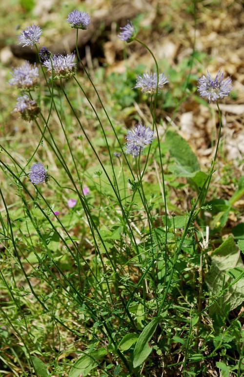
Copyright © : Geonat'ÎdF - Lobelia